Bugzeye™ Drone Mapping and PhotographyServing all of Arizona(480) 953-0626

Services

Construction Mapping & Photography

At Bugzeye Drone Mapping & Photography, we specialize in advanced construction mapping and imaging solutions designed to support construction companies and professionals throughout the lifecycle of their projects. Our drone-based services, combined with traditional land surveyor techniques, deliver highly accurate data to support planning, building, and safety across construction projects. From pre-construction mapping to construction phase management to post-construction analyses, we provide precise, high-quality data for job sites of all sizes, ensuring efficiency and success for your project team.

We want to make your project easier. Let us complete it quicker and for less.

Tell us about your project

Phases of Construction Mapping: Pre, Phased, and Post

Construction mapping is a vital part of any building project and is divided into three essential phases. Each phase plays a significant role in ensuring the quality and accuracy of construction plans and outcomes.

Pre-Construction Mapping

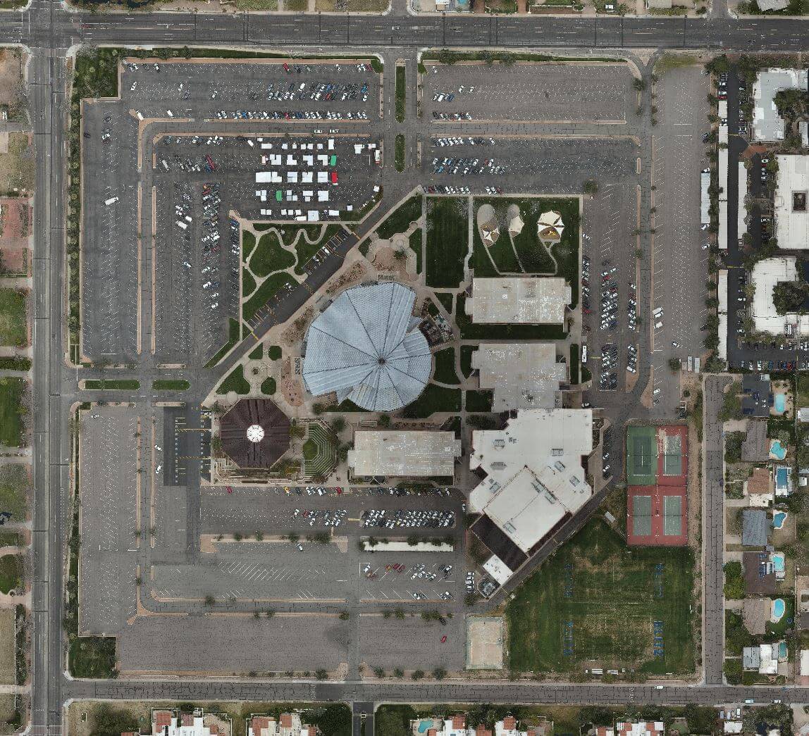
Pre-construction data is critical for understanding the lay of the land before breaking ground. This data maps the terrain, identifies utility lines, and provides essential data for construction plans. Bugzeye utilizes advanced drone technology, including orthophotography and orthomosaic imaging, to deliver accurate digital representations of the project area. These tools help construction teams address site-specific challenges early in the construction process.

Phased Construction Imaging

During the construction phase of the process, phased imaging tracks progress at different stages of the project. With tools like orthophotography, 3D mesh modeling, and CAD integration, Bugzeye provides a detailed view of each phase. This data allows project managers to measure completion percentages, monitor materials, and ensure construction plans stay on track. Our drones can return to the site multiple times as needed, capturing updated data quickly and efficiently for total quality control.

Post-Construction Imaging and Mapping

Post-construction imaging documents the completed structures and surrounding land, creating a final record of the project. These images and maps are essential for as-built models, compliance verification, and future maintenance. Using orthomosaic imaging and CAD tools, we ensure the final results align with the original construction plans, providing a reliable foundation for any future development.

Contact Us to Learn More


The Advantages of Drone-Based Construction Monitoring

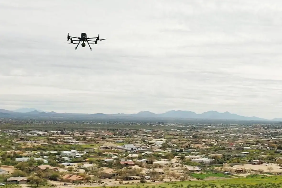
Drone technology has revolutionized the construction industry by providing faster, more accurate, and cost-effective solutions for mapping. Here’s why drones are a game-changer for construction site mapping:

  • Time and Cost Savings: Drones save days of work compared to traditional surveying methods, reducing labor costs and expediting project timelines.
  • Detailed Data: With orthophotography, LiDAR scanning, and 3D mesh modeling, drones provide comprehensive data that surpasses the amount of data provided by manual surveys alone.
  • Wide Range of Applications: From tracking progress to utility mapping, drones offer solutions for a wide range of needs on construction sites.
  • Enhanced Accuracy: Drone mapping minimizes human error, delivering accurate data that supports better decision-making throughout the digital construction journey. 
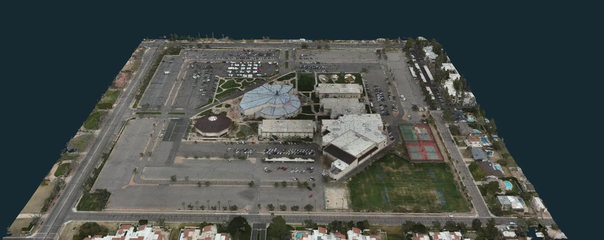
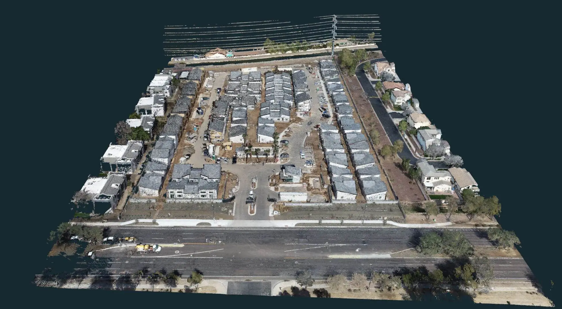
3D Mesh Model 
3D Mesh Model 
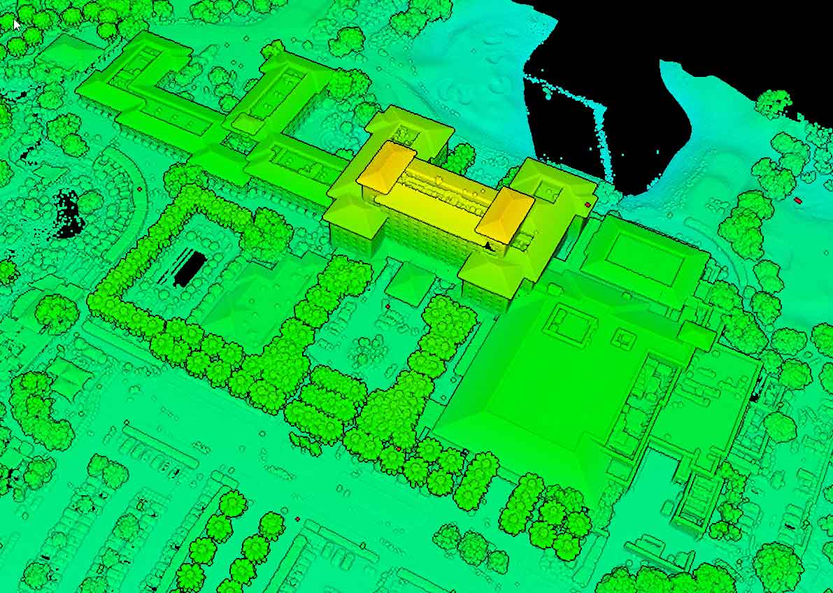
LiDAR Reflective Point Cloud

Land Surveying, Quantity Surveying, and Beyond

Bugzeye's services extend to both land surveying and quantity surveying, providing a versatile toolkit for construction companies. Our ability to deliver accurate measurements and data supports seamless construction processes, from initial design to final execution.

Land Surveying

With tools like orthomosaic imaging and LiDAR, our data can be used by the surveyor to produce highly accurate topographic maps and more. Land surveyors rely on this data to create precise construction plans that align with the terrain and comply with zoning laws.

Learn more on our Land Surveying Page.

Quantity Surveying

Our quantity imaging and scanning services help project surveyors calculate material volumes and requirements with exceptional accuracy. This is especially critical during earthmoving operations, where precise calculations can prevent waste and ensure the efficient allocation of resources. By integrating drone data into CAD systems, we provide clients with actionable insights to optimize their workflows.

Contact Us to Learn More

++++++++

Drone Mapping and the Digital Construction Journey

Bugzeye’s drone mapping services support the digital transformation of construction projects. By integrating cutting-edge tools like LiDAR, orthomosaic imagery, and 3D mesh modeling, we provide project teams with a complete digital representation of their job sites.

  • 3D Mesh Models: These 3D models offer an interactive view of structures and landscapes, supporting detailed analysis and planning.
  • Orthomosaic Imaging: High-resolution, georeferenced images provide a detailed, accurate map of the site.
  • LiDAR Scanning: For complex terrain or vegetation, LiDAR technology delivers precise elevation data, enabling better grading and excavation plans.
  • CAD Integration: Our data is fully compatible with CAD software, making it easy to incorporate into existing workflows and construction plans.

Learn more on our Drone Mapping Page.

Supporting Safety and Quality on Construction Sites

Safety and quality are at the forefront of every construction project, and Bugzeye's services are designed to uphold these standards:

  • Improved Safety: Drone imaging and scanning allows for remote monitoring of job sites, reducing the need for on-site personnel in hazardous areas.
  • Detailed Inspections: With tools like LiDAR and orthophotography, we identify potential safety risks and quality issues before they escalate.
  • Compliance and Documentation: Our images and scans help ensure that construction plans are executed accurately, supporting compliance with regulatory requirements and providing a clear record of progress.

Set up a Consultation

++++++++

Road Construction Surveying

Infrastructure projects like road construction require specialized surveying and mapping services, and Bugzeye delivers the precision and efficiency these projects demand.

Road Work Surveying

Using drones equipped with advanced imaging tools, we provide detailed data for road alignment, grading, and material planning. This data allows the surveyor to streamline workflows, helping construction teams manage timelines and resources effectively.

Challenges in Construction Photography and Surveying

While drone-based construction photography and surveying provide numerous advantages, certain challenges can arise for any construction surveyor. For instance, ongoing activity at job sites, such as moving equipment or materials could inadvertently move ground control points, inclement winds and weather or safety concerns can also provide challenges. Our team mitigates these challenges by coordinating closely with construction teams to schedule optimal mapping times and by double checking all control points for accuracy. Additionally, selecting the right drone and payload, such as LiDAR for detailed mapping or high-resolution cameras for imaging, ensures that data collection is precise and aligned with project goals.

How Drones Save Time on Building Projects

The speed of drone mapping is unmatched, often completing tasks in hours that traditionally take days. For phased construction projects, drones provide updated data at each stage, enabling construction teams to make informed decisions quickly. This efficiency keeps projects on track, project costs down and reduces downtime between phases.

Set up a Consultation

Custom Pricing for Every Project

Bugzeye offers flexible, competitive pricing tailored to the unique needs of each project. Factors that influence costs include site size, imaging resolution, complexity, and the number of on-site visits. Despite the premium quality of our services, we remain committed to offering competitive rates that deliver exceptional value for construction companies and their project teams.

+++++

Why Does the Construction Industry Choose Bugzeye?

Bugzeye Drone Mapping & Photography combines expertise, advanced technology, and a commitment to quality to deliver reliable results for every construction project. With services like construction site mapping, utility mapping, and LiDAR imaging, we provide the data and insights you need to ensure success. Whether you're working on road construction, utility mapping, or large-scale developments, we are here to support your digital construction journey with precision and efficiency.

Set up a Consultation