Bugzeye™ Drone Mapping and PhotographyServing all of Arizona(480) 953-0626

Services

Drone Technology for the Mining Industry

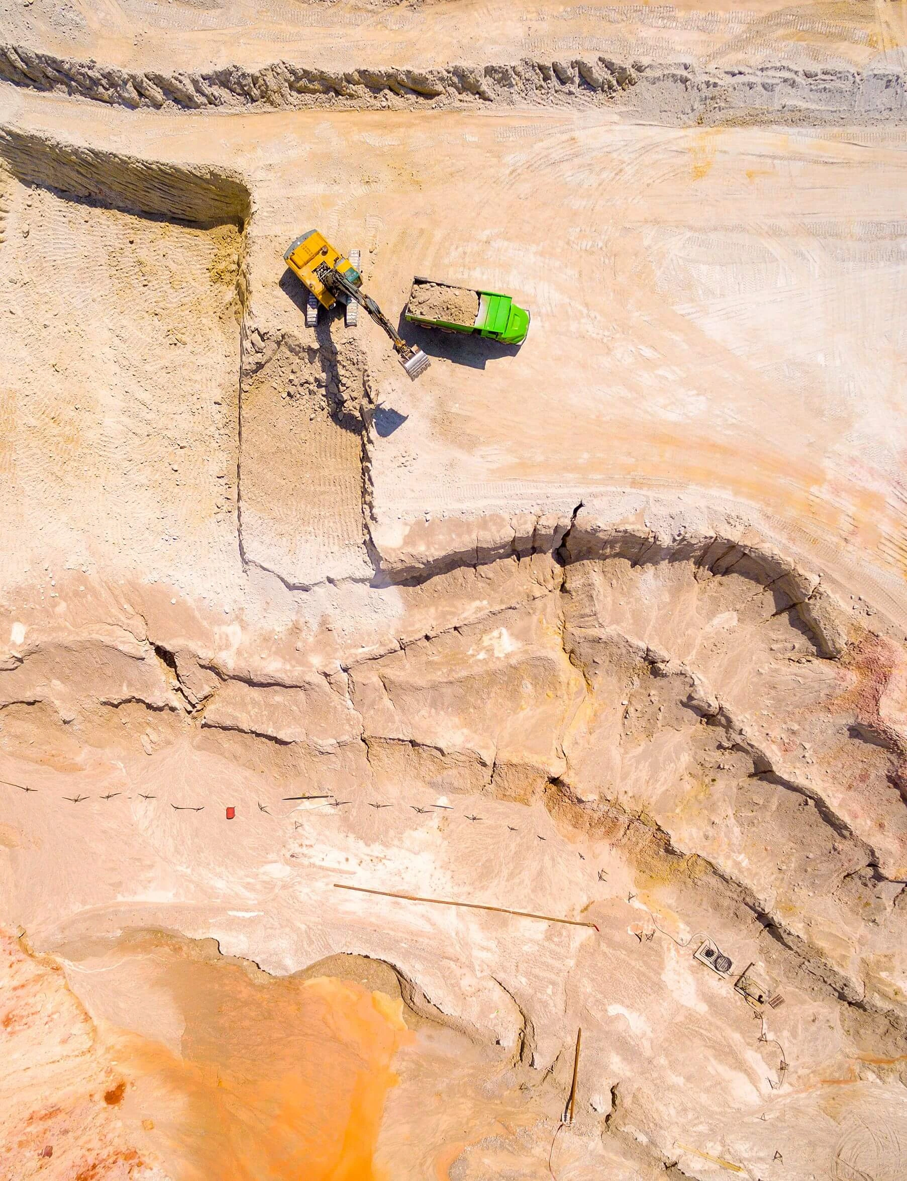
The mining industry faces unique challenges that demand precision, efficiency, and safety. Bugzeye Drone Mapping & Photography offers cutting-edge drone solutions designed to support mining operations, from preliminary mapping to inventory management and environmental monitoring. Our mining drones provide high-resolution images, accurate measurements, and real-time data, empowering mining companies to streamline processes and improve decision-making. Whether for open-pit sites or preliminary exploration, drones in mining are transforming traditional methods with innovative technology.

We want to make your project easier. Let us complete it quicker and for less.

Tell us about your project

Applications of Bugzeye Mining Drones

Bugzeye's mining systems serve a wide range of applications in the mining sector, making them an indispensable tool for modern mining operations. From mapping terrain to tracking inventory, our technology delivers actionable data that enhances both safety and productivity.

  • Mining Exploration: Aerial terrain models enable detailed analysis of areas with resource potential, offering mining operators an efficient way to identify high-yield sites. This process eliminates much of the guesswork associated with traditional exploration methods and saves valuable time in assessing new opportunities.
  • Volume Estimations: Measuring stockpiles and excavation areas with unmatched precision reduces errors that often occur with manual inspections. Mining operators can confidently base decisions on accurate metrics, improving resource allocation and financial planning.
  • Sediment Flow Monitoring: Monitoring sediment displacement provides essential data for understanding how mining activities impact the surrounding environment. Regular assessments enable teams to adjust their methods to maintain compliance with regulations while mitigating long-term effects on ecosystems.

By integrating aerial mapping into mining operations, companies gain access to actionable insights that improve the efficiency of their projects. These tools are especially effective in identifying opportunities for optimizing resource use and mitigating risks in dangerous environments.

Drone Mapping

Aerial mapping lies at the core of Bugzeye's services for the mining industry. Equipped with advanced imaging tools, Bugzeye performs aerial mapping to generate detailed, accurate data for project planning and monitoring.

Digital Surface Models

Digital surface models (DSMs) provide a 3D representation of the mining site, capturing the contours and elevation of the terrain. These models offer invaluable support for understanding site conditions, enabling accurate planning and minimizing blind spots. Combined with digital terrain models (DTMs) and digital elevation models (DEMs), these outputs ensure mining teams have the information they need to optimize excavation strategies.

Surface models are especially useful for planning projects in inaccessible terrain. Teams can evaluate elevation changes, identify potential safety hazards, and forecast the logistical challenges of moving heavy equipment across complex landscapes. This detailed analysis allows for more informed planning, reducing costly delays caused by unforeseen obstacles in the field.

Stockpile Management

Frequent stockpile measurements are crucial for inventory management and financial reporting. By providing accurate volume estimations, Bugzeye enables companies to allocate resources efficiently and avoid costly discrepancies. Regular measurements also support frequent updates to inventory systems, ensuring financial reports are based on reliable, up-to-date data.

Advanced imaging technology eliminates the need for time-intensive manual inspections, which often require stopping operations to ensure accuracy. Instead, automated assessments provide mining operators with the data they need while allowing workflows to continue uninterrupted. This seamless integration keeps projects moving efficiently, even on larger, more complex sites.

Environmental Monitoring

Aerial mapping enables real-time monitoring of environmental factors, such as sediment displacement and vegetation changes. This data helps companies maintain compliance with environmental regulations while minimizing their ecological footprint. Insights gained through monitoring help mining teams assess how operations impact water quality, sediment flow, and local ecosystems.

Environmental assessments are essential not only for regulatory compliance but also for demonstrating corporate responsibility. By prioritizing sustainability, mining companies can improve relationships with local communities and avoid disruptions caused by environmental violations.

Aerial Photography

High-resolution photography provides an overhead view of mining sites, capturing detailed images of operations, equipment placement, and site layout. These visuals are critical for presentations, planning documents, and stakeholder communication. Mining teams rely on these images to showcase the progress and scale of their projects, ensuring all stakeholders have a clear understanding of site conditions.

Operators also use these images to highlight improvements in efficiency and adherence to safety protocols. Such documentation can serve as a powerful tool for demonstrating compliance during audits or securing investments for future expansion.

Learn more on our Aerial Photography Page.

++++++++

Safety Enhancements through Drones

Mining is a dangerous industry, but advanced imaging technology is helping to create safer working conditions by reducing risks associated with traditional inspection techniques and ground-based surveying missions.

Drone Hazard Identification

Aerial mapping is instrumental in identifying hazards in hard-to-reach areas, such as steep slopes, unstable surfaces, and excavation sites. By capturing detailed visuals, potential risks can be assessed without exposing workers to unnecessary danger. This process not only reduces accidents but also ensures that operations comply with safety protocols.

The ability to identify hazards in inaccessible terrain allows teams to take preventative measures before issues escalate. Operators can reassign resources, adjust schedules, or reconfigure workflows to ensure worker safety remains a top priority.

Monitoring & Inspection

For mining operations, regular monitoring and equipment inspections are essential to maintain structural integrity and prevent accidents. Advanced imaging provides enhanced worker security by allowing inspections in hazardous environments, such as unstable pits or near heavy machinery. This reduces the need for human involvement in dangerous areas, adhering to strict safety protocols.

Automated inspections also ensure that high-risk areas are evaluated consistently over time. By identifying changes early, operators can schedule maintenance proactively, avoiding costly repairs and reducing risks to personnel.

Contact Us to Learn More

Cost-Effectiveness of Drone Technology

Imaging solutions offer significant cost savings to the mining sector by improving efficiency and reducing the need for labor-intensive traditional methods. Bugzeye's operations are designed to maximize value while minimizing costs.

Increased Efficiency

Modern imaging systems complete surveying missions and mapping tasks in a fraction of the time required by traditional methods. For example, an aerial imaging session can collect data across an entire site in just a few hours, compared to days of manual ground-based techniques. This increased efficiency translates into faster decision-making and shorter project timelines.

Increased speed does not compromise quality. By reducing the time spent collecting data, teams can focus more on analysis and application, improving the overall workflow of mining operations.

Accuracy in Data Collection

Accurate measurements are essential for effective mining operations. Bugzeye delivers precise data through tools like geographic information systems (GIS), 3D point clouds, and orthophotography. These outputs eliminate errors common in manual methods, ensuring that mining companies can rely on the information to make informed decisions.

Enhanced accuracy also supports better financial planning. Mining operators can use reliable data to improve budgeting, allocate resources effectively, and avoid costly overruns caused by inaccurate volume estimations.

Drone Capabilities

Our imaging systems are equipped with advanced features that make them versatile and highly effective for mining applications.

Autonomous Drone Navigation

Automated navigation simplifies mapping missions by optimizing flight paths and data collection processes. This capability allows teams to focus on analyzing results rather than coordinating manual operations.

Autonomous systems are especially valuable in dangerous environments, where minimizing human exposure is essential. Navigation technology ensures consistent, thorough coverage of mining sites, even in the most challenging conditions.

3D Models

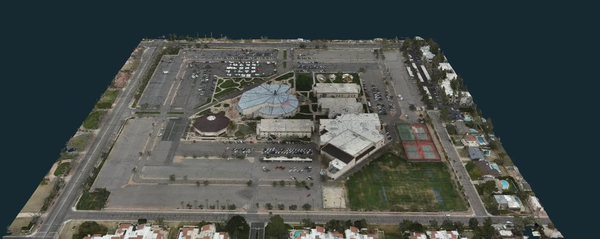
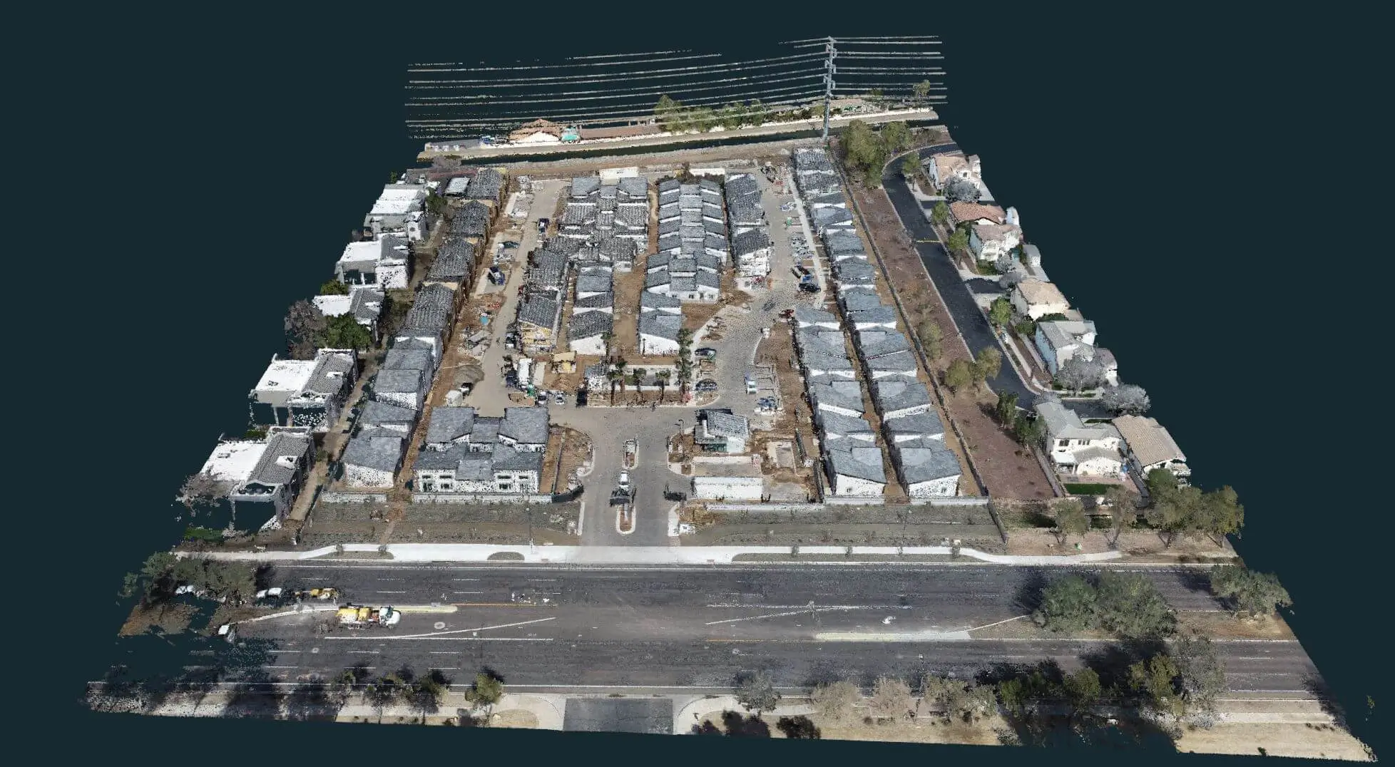
Advanced imaging tools generate 3D point clouds and mesh models that provide a detailed digital representation of mining sites. These models are invaluable for tracking excavation progress, planning new projects, and assessing structural integrity in areas that are difficult to access manually.

The ability to visualize site changes over time also supports long-term planning efforts. Teams can monitor how conditions evolve and adjust their strategies to maintain efficiency and safety.

Browse our 3D Modeling Page.

Let's Discuss Your Needs

Bugzeye Drone Mapping & Photography is committed to providing innovative drone solutions for the mining industry. From aerial surveys to advanced mapping and inspection methods, our services are designed to enhance efficiency, safety, and profitability for mining operations. Whether you're exploring new sites or managing active mines, our commercial drones and experienced team can help you achieve your goals.

Contact us today to learn more about how our drone technology can support your mining projects. We'll work with you to develop a customized solution that meets your specific needs, providing you with the tools and insights you need to succeed.

Contact Us to Learn More

++++++++